
Our Workflow Planning Strategy
Our primary service offering centers on providing exceptional aerial photography services for survey and mapping, with a wide range of potential applications across large and small-scale projects alike. Our stunning high-definition imagery is ideal for property portfolios, structural inspections, and even specialized requirements such as archaeological or industrial surveys. In addition, we have expanded our capabilities to include high-resolution data collection via a variety of unmanned aircraft systems (UAVs).

Pre-flight Planning
-
Build the route.
-
Scope out the landscape.
-
Preview the Flight.
-
Check your flight path.
Post-Flight Processing
-
Post processing.
-
Cataloging.
-
Convert and Geo-reference.
-
Assimilate with Drone Platforms.
Data Delivery
-
Cloud Control
-
Result Cooperation
-
Report Production
Service Deliverables

Ground Control Point (GCP) Collection
Data Processing

Topographic Survey Plans

Flight Planning

Orthophoto Mosiac

Thermal Mapping

Image Acquisition & Aerial Procedures

Oblique Imagery

LiDAR Survey

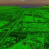
Our Photogrammetry

Fujairah

Quarry - Fujairah

Old Town - Umm Al Quwain

Old Royal House - Umm Al Quwain
